Watershed Analysis using GIS

Why take this course?
🌱 Master Watershed Analysis with GIS: A Comprehensive Journey for GIS Enthusiasts! GroupLayout: 10 Weeks | Level: Intermediate-Advanced | Instructor: Bijaya Maharjan
🎉 Course Headline: "Unlock the Power of GIS in Watershed Management – Your Pathway to Mastery Begins Here!"
📑 Course Description:
Welcome, GIS enthusiasts and environmental stewards! Dive deep into the world of hydrology and geospatial analysis with our Watershed Analysis using GIS course. This interactive online experience is tailored for those eager to expand their skills in utilizing GIS tools to analyze and understand watershed dynamics.
Key Features of the Course:
-
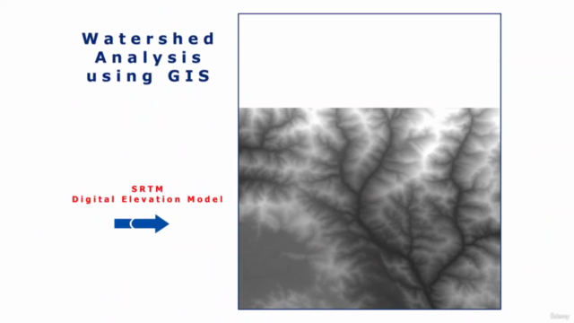
SRTM DEM Exploration: Learn how to access and work with the Shuttle Radar Topography Mission (SRTM) Digital Elevation Model data for your study area.
-
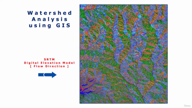
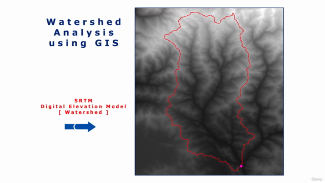
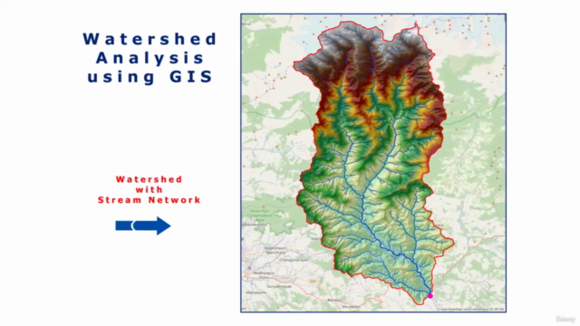
Hydrology Tools Mastery: Utilize ArcGIS hydrology tools to delineate watershed boundaries, identify stream networks, and determine stream orders.
-
Watershed Characterization: Understand the significance of a watershed as an ecological unit and learn how to estimate storage area and volume at different elevation ranges using variable dam heights.
-
Data Analysis with ArcGIS: Gain hands-on experience in analyzing and interpreting hydrological data within the ArcGIS platform.
-
Map Design & Layout Preparation: Master the art of map compilation by preparing a comprehensive layout that effectively communicates your findings.
Course Structure Overview:
-
Introduction to Watershed Analysis:
- Understanding watersheds and their importance in hydrology.
- Overview of the SRTM DEM and its applications.
-
Data Acquisition & Preparation:
- How to download and process SRTM DEM data for your study area.
- Setting up your GIS environment for watershed analysis.
-
Delineation of Watershed Boundaries:
- Techniques for defining watershed areas using ArcGIS tools.
- Identifying pour points and stream networks with hydrologic analyses.
-
Hydrological Modeling & Volume Estimation:
- Estimating storage area and volume within the watershed using various dam heights.
- Understanding the implications of your findings on watershed management.
-
Map Design & Communication:
- Creating a clear and informative map layout.
- Incorporating essential elements that make a map effective, such as legends, scale bars, and annotations.
What You Will Achieve:
- Proficiency in using GIS tools for watershed analysis.
- Ability to interpret and communicate complex hydrological data through clear maps.
- A deep understanding of the role of watersheds in ecosystem functions and human water supply.
- A comprehensive portfolio showcasing your skills in watershed mapping and analysis.
Who Should Take This Course:
- Environmental scientists and engineers.
- GIS professionals looking to specialize in hydrology and environmental studies.
- Undergraduate and graduate students in geography, environmental science, or related fields.
- Anyone with an interest in geospatial analysis and its applications in natural resource management.
📅 Enrollment is Open! Secure your spot and embark on a transformative learning journey today. Let's turn the power of GIS into actionable insights for watershed management. 🌟
Course Gallery


Loading charts...